Maps and Graphics by John Brebner
During the course of preparing promotional materials, posters and lecture presentations, we often have a need for custom maps and graphics.These are a few. Feel free to use them for educational or personal use only!
Some of the full-size images are quite large!
All graphics are designed to be easily modified. Please let us know if there are errors, and we will correct them!
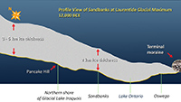
|
Description:
Cross-section of Laurentide Glacier over Sandbanks
Date/Source: February, 2021; John A. Brebner |
|
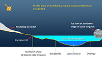
|
Description:
Receding Laurentide Glacier with glacial Lake Iroquois over Sandbanks
Date/Source: February, 2021; John A. Brebner |
|
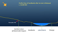
|
Description:
Cross-section of Sandbanks with Lake Ontario
Date/Source: February, 2021; John A. Brebner |
|
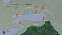
|
Description:
Extent of Laurentide Glacier Ice Coverage
Date/Source: February, 2021; John A. Brebner |
|
|
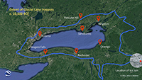
Description:
Extent of Glacial Lake Iroquois
Date/Source: February, 2021; John A. Brebner |
|
|
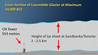
Description:
Comparison of glacier with CN Tower
Date/Source: February, 2021; John A. Brebner |
|
|
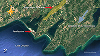
Description:
Map, Ridge Road and Sand Movement
Date/Source: February, 2021; John A. Brebner |
|
|
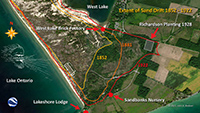
Description:
Map, Sand Movement 1852 - 1922
Date/Source: February, 2021; John A. Brebner |
|
|
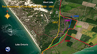
Description:
Map, Relocation of County Road 12, 1852 - 1965
Date/Source: February, 2021; John A. Brebner |
|
|
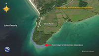
Description:
Map, Ordovician Fossils at West Point
Date/Source: February, 2021; John A. Brebner |
|
|
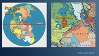
Description:
Map, Sandbanks and Pangea
Date/Source: February, 2021; John A. Brebner |
|
|
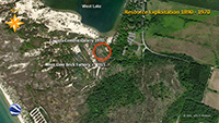
Description:
Map, Resource Exploitation at Sandbanks
Date/Source: February, 2021; John A. Brebner |
|
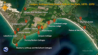
|
Description:
Map, Lodges and Cottages 1870 - 1970
Date/Source: February, 2021; John A. Brebner |
|
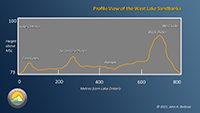
|
Description:
West Lake Sand Dune Topography
Date/Source: February, 2021; John A. Brebner |
|
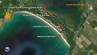
|
Description:
Outlet River Bridges
Date/Source: February, 2021; John A. Brebner |
|
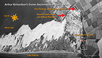
|
Description:
Richardson's Nursery and Plantings, 1950 aerial
Date/Source: February, 2021; John A. Brebner |
|
|
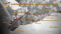
Description:
Block H Architecture, 1950 aerial
Date/Source: February, 2021; John A. Brebner |
|
|
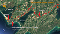
Description:
Pine and Cedar at Sandbanks, Mast Road
Date/Source: February, 2021; John A. Brebner |
